Find out what the phenomenon observed in the country is.
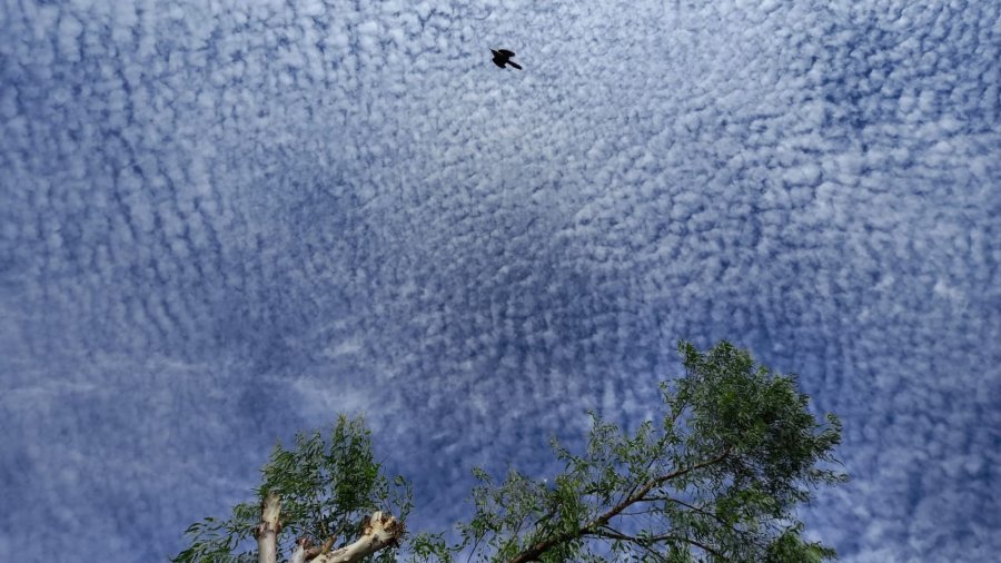
Cirrocumulus is the name given to the formation of clouds that were seen during Tuesday morning in the country.
According to the Spanish portal weather.com, this type of cloud “is one of the most spectacular and extends over hundreds of kilometers.”
Salvadoran meteorologist Sandra Martínez shared some images and explained through her Twitter account what this phenomenon consists of.
YOU MAY BE INTERESTED IN: Spectacular! An “advection fog” covered Coatepeque Lake, what is the reason for this phenomenon?
“These types of clouds are ripples in the thermodynamics of the atmosphere; it usually indicates that hot air is rising, generating chances of rain,” he explained.

Image taken at 05:57 on Tuesday morning near the parish of Sant Carles Borromeu. Thus the formation of the clouds in the Union was appreciated. Photo: EDH / Insy Mendoza
For this reason, the expert predicts that “for the next few days, we may see the first showers or some storm over the territory.”
After experiencing this environment, “we return to other dry days and so on; preparing to receive the transition from the dry season to the rainy season,” he pointed out.
Sandra Martínez studied at the University of El Salvador (UES) and at the National Oceanic and Atmospheric Administration (NOAA). She is certified and accredited as a meteorologist and hydrologist by the United States Department of Commerce. In addition, he studied in Spain, Guatemala and the United States.
In December 2019 he retired from the position of meteorologist who held for several years in the Ministry of Environment due to his retirement, as he has confirmed to this newspaper on this occasion. At present it continues exerting the profession in the state channel news program.
YOU MAY BE INTERESTED IN: Spectacular cloud formations in El Salvador due to Iota influence